Lunnabjär
Created by Lukas Carpelan
A burial mound from the bronze age
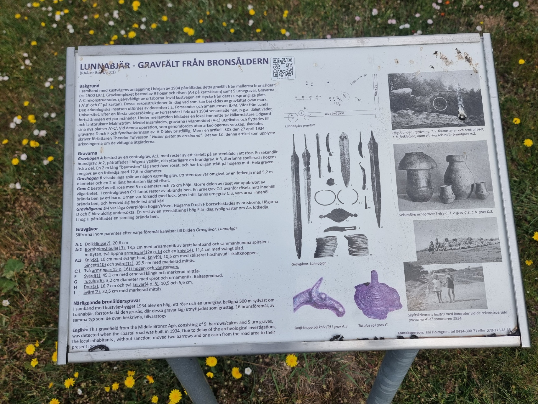
LUNNABJÄR- BRONZE AGE GRAVE FIELD (RAÄ-nr Boroy3:1) Background (ca. 1500 BC). The grave complex consisted of 9 mounds and cairns (A-l on the map sketch) and 5 urn graves. Graves A-C were independently reconstructed by the locals along the coastal road a short distance from their original location (A',B' and C' on the map). These reconstructions are today what can be seen of the grave field above ground. The archaeological work was carried out by associate professor J.E. Forssander and amanuense B.-M. Vifot from Lund: University. After an initial investigation by Forssander in February 1934, he postponed the continuation for a couple of months due to bad weather. In the meantime, a local committee was formed by cellar master Odgaard ⁃ and farmer Malmström. Funds were collected, the graves in the road area (A-C) were excavated and moved to their new locations A'-C". During this operation, which was carried out without the archaeologists' knowledge, graves D and F were damaged and the handling of finds A-D was inadequate. However, in an article in SDS on 27 April 1934, the author Theodor Tufvesson writes "Beautiful piety of the locals". It was this article that informed the archaeologists about the lost graves.
Nearby
More in Sights
Sources
Contributed by Lukas Carpelan. Licensed CC BY-SA 4.0.